 Hable con un agente al (888) 572-7520
  Enviar mensaje a un agente

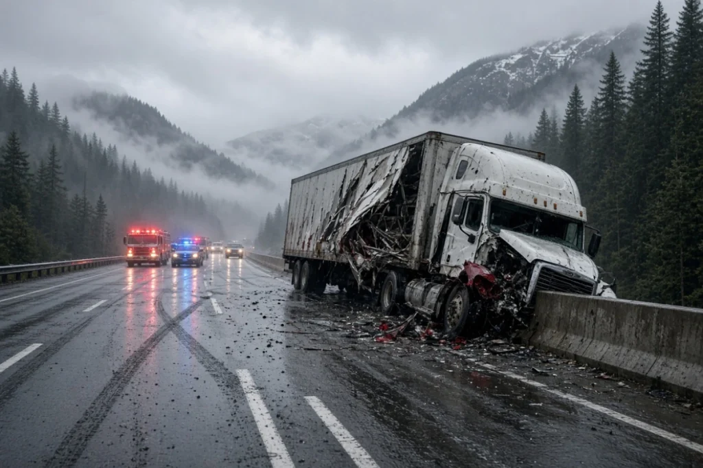

In Washington, the routes posing the greatest risk to trucks are I-90 at Snoqualmie Pass, US-2 through Stevens Pass, and I-5, due to their extremely high daily traffic volumes combined with heavy truck traffic.
The Roads With the Highest Accident Risk: The National Picture
According to IIHS figures based on the federal Fatality Analysis Reporting System (FARS), large trucks represented only 5% of all registered vehicles in the country in 2024, but they were involved in 14% of all traffic fatalities. The fatal crash rate for large trucks was 1.6 per 100 million miles traveled, slightly higher than the rate for passenger vehicles.
One fact that often comes as a surprise is that 71% of large-truck occupant fatalities in 2024 occurred in rural areas, not cities. In addition, 47% of those deaths occurred in rollover crashes, a much higher proportion than among cars or pickup trucks.
Looking at specific corridors, an analysis of data from the Federal Motor Carrier Safety Administration (FMCSA) and the NHTSA ranks Texas, Florida, California, Georgia, and North Carolina as the five states with the highest total number of truck-crash fatalities. When measured by rate—deaths per mile traveled or per registered vehicle—the ranking changes, and sparsely populated states such as Montana and Wyoming move higher because long distances, extreme weather, and delays in emergency response increase the risk per trip.
Among interstate highways, corridors such as I-95 along the East Coast, I-35 from Laredo, Texas, to Minnesota, and I-10 across the southern United States repeatedly appear among the country’s most dangerous. This is due to the combination of high traffic volumes, a large number of long-haul trucks, and, in some sections, adverse weather or road-design conditions.
Washington: The Routes With the Highest Risk
I-90 and the Snoqualmie Pass “Danger Zone”
The 42-mile section of I-90 between the Snoqualmie Pass summit and the Indian John Hill rest area, near Cle Elum, is known among authorities and specialized law firms as the “I-90 Danger Zone.” More than 20,000 vehicles travel through this area each day, with peaks of up to 50,000 on weekends. Sharp curves, steep grades, and winter weather—including snow, ice, and strong winds—can lead to loss-of-control crashes, jackknifed tractor-trailers, and multiple-vehicle collisions.
The Washington State Department of Transportation (WSDOT) and the Washington State Patrol (WSP) regularly report I-90 closures in this section due to fatal truck crashes, including chain-reaction collisions that have shut down the highway for hours.
US-2 and Stevens Pass: The Risk of Isolation
US-2, which connects Spokane and Seattle through Stevens Pass, presents a different type of risk: isolation. It is a two-lane road with very remote sections, where emergency response times can reach 80 minutes and cell service is intermittent. Over the past 15 years, more than 60 people have died in crashes on this route, many of them linked to winter ice and snow conditions at the mountain pass.
I-5: The Highest-Volume Corridor
I-5 is the north–south highway that runs through the entire state, with traffic exceeding 200,000 vehicles per day on some urban sections of Seattle and Tacoma. This extreme volume, combined with the large number of freight trucks entering and leaving the Seattle–Tacoma port complex, increases the statistical likelihood of crashes, although the average severity per incident is generally lower than on mountain passes.
SR 522: A Road-Design Case
State Route 522 north of Seattle is identified by road-safety specialists as an example of risk associated with road design. Narrow lanes, the absence of center dividers, minimal shoulders, and sharp curves combine to increase the risk of head-on and side-impact crashes, including those involving trucks.
Pacific Highway / SR-99 in Kent
The section of Pacific Highway between South 252nd Street and South 176th Street in Kent records approximately 1.8 fatal crashes per mile per year, one of the highest rates in the state on a corridor with heavy commercial and logistics traffic.
Why These Routes Have Higher Risk
Road-safety specialists and state authorities agree on a common pattern: risk in Washington does not depend on a single factor but rather on the combination of several factors.
- Mountain weather: Snow, ice, and wind at Snoqualmie Pass and Stevens Pass can turn a normal curve into a surface with no traction within minutes.
- Traffic volume: I-5 and I-90 carry a substantial share of freight traffic in the Pacific Northwest.
- Road design: Narrow lanes, sharp curves, and the absence of shoulders or dividers on roads such as SR 522.
- Remoteness: On US-2, the problem is not only the crash itself but also the delay in receiving medical assistance.
- Driver behavior: According to the Washington Traffic Safety Commission (WTSC), speeding, distracted driving, and failure to wear a seat belt remain the factors most frequently cited in the state’s fatal-crash reports.
What Transportation Companies and Owner-Operators Can Do
For fleets and independent drivers operating in or traveling to Washington, transportation safety agencies and industry specialists recommend prioritizing route planning based on seasonal weather conditions, especially when crossing mountain passes during the winter months. They also recommend strengthening brake and tire inspections before traveling through areas such as Snoqualmie Pass or Stevens Pass, where a mechanical failure can be compounded by steep grades.
Frequently Asked Questions
What is the most dangerous route for trucks in Washington?
There is no single official answer, but the section of I-90 known as the “Danger Zone” at Snoqualmie Pass and US-2 at Stevens Pass are the routes most frequently mentioned in reports of fatal truck crashes because of extreme weather and, in the case of US-2, isolation and delayed emergency assistance.
How many people die in truck crashes in the United States each year?
In 2024, 5,340 people died in crashes involving large trucks nationwide, according to IIHS data based on the federal FARS system.
Do truck crashes happen more often in urban or rural areas?
Mostly in rural areas: 71% of large-truck occupant fatalities in 2024 occurred in rural locations, according to the IIHS.
Which states have the most truck-crash fatalities?
By total number of deaths, Texas, Florida, California, Georgia, and North Carolina lead the national ranking. When measured by the fatality rate relative to population or miles traveled, sparsely populated states such as Montana and Wyoming appear among those with the highest relative risk.
 Business hours: Monday to Friday from 8:00 AM to 5:00 PM. California time