 Hable con un agente al (888) 572-7520
 Enviar mensaje a un agente


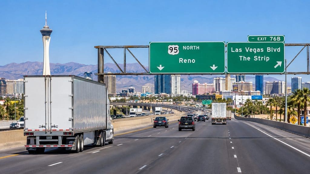

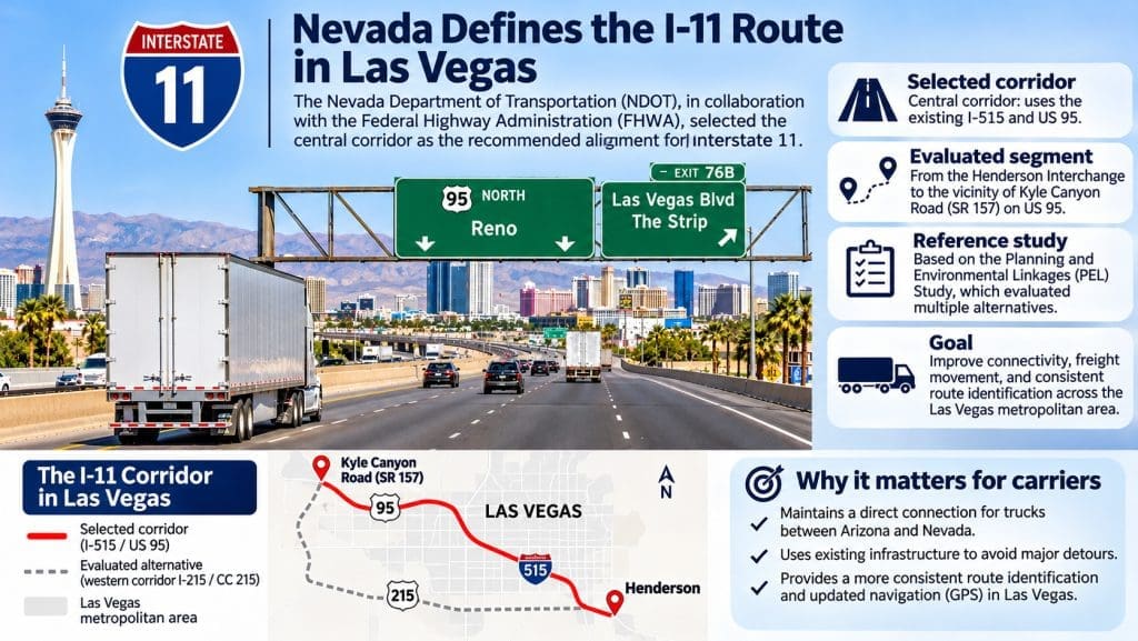
he Nevada Department of Transportation (NDOT), in cooperation with the Federal Highway Administration (FHWA), selected the central corridor through Las Vegas as the recommended alignment for Interstate 11 (I-11), a strategic transportation corridor for freight movement across the southwestern United States.
The selected alternative follows the existing I-515 and US 95 highways, paving the way for more consistent route identification throughout the metropolitan area.
The recommendation comes from the Planning and Environmental Linkages (PEL) study, whose final report serves as the project’s official planning reference. The study evaluated alternatives connecting the Henderson Interchange, southeast of Las Vegas, to the vicinity of Kyle Canyon Road (SR 157) along US 95, northwest of the city.
For truck drivers, logistics companies, and commercial fleet operators, selecting the central corridor represents an important step toward improving route continuity between Arizona, Nevada, and other destinations across the western United States.
The project still requires formal interstate designation procedures and infrastructure updates, including signage and navigation changes that will depend on available funding.
Why Nevada Selected the Central Corridor
The NDOT study evaluated two main alternatives for the future I-11 alignment through Las Vegas: the western corridor, following I-215 and CC 215, and the central corridor, using the existing I-515 and US 95.
The western alternative included two options. One would use existing infrastructure through the Centennial Bowl interchange, while the other would require approximately five miles of new freeway construction, along with additional environmental studies and approval procedures.
The central corridor follows highways already integrated into the metropolitan transportation network and requires no major infrastructure modifications to establish the recommended alignment.
After reviewing technical, operational, and environmental criteria, NDOT identified the central alternative as the best-performing option overall.
The decision takes advantage of an existing highway connection without requiring construction of an entirely new corridor through the city. It also provides a clearer framework for future transportation investments and regional traffic planning.
What This Means for Trucks Traveling Through Las Vegas
Las Vegas occupies a strategic position within the highway network connecting Arizona, Nevada, and other markets throughout the western United States.
Its highways carry long-haul trucks, regional delivery vehicles, and commercial fleets supplying shopping centers, warehouses, industrial facilities, and businesses associated with the tourism industry.
Identifying the central corridor as I-11 could simplify route planning by establishing a more consistent interstate highway designation.
For truck drivers entering Nevada from Arizona and continuing toward northern Nevada, the central corridor provides a direct connection through the metropolitan area without requiring a detour around the city’s outer beltways.
Carriers will continue selecting routes based on their destinations, traffic conditions, commercial vehicle restrictions, and truck-specific navigation instructions.
The primary benefits identified by transportation officials are improved connectivity and clearer highway navigation.
New Highway Signs and GPS Navigation Updates
One of the most significant aspects of the project for commercial transportation will be updating highway signage.
Drivers currently encounter different highway designations along the routes crossing Las Vegas. The I-11 designation will provide more consistent identification throughout the selected corridor.
According to NDOT, the next steps include formal interstate designation through the American Association of State Highway and Transportation Officials (AASHTO), followed by the design and installation of updated highway signs.
Changes are also expected in digital navigation platforms, including Google Maps, Apple Maps, and Waze.
For trucking companies, these updates will have practical implications. Fleet management systems, commercial truck GPS devices, and dispatch instructions will need to reflect official highway designations as they are implemented.
A coordinated transition can help reduce confusion between the route names used by drivers, directions provided by distribution centers, and signs displayed along the highway.
Carriers should continue using the highway designations currently in effect until transportation authorities officially implement the changes. Fleet navigation databases should be updated according to published information.
A Strategic Interstate Highway for Freight Transportation
The Interstate 11 project dates back to 2012, when Congress identified the US 93 corridor between Phoenix, Arizona, and Las Vegas, Nevada, as a high-priority transportation connection under the Moving Ahead for Progress in the 21st Century Act (MAP-21).
Since then, I-11 has been envisioned as part of a north-south transportation strategy designed to improve passenger mobility and freight movement.
The project aims to strengthen connections between metropolitan areas, production centers, consumer markets, and major commercial transportation corridors.
Over the long term, the regional vision includes expanding transportation connections to other parts of the western United States and supporting integration with international trade routes.
For the trucking industry, a more clearly identified and connected interstate network can improve logistics planning, particularly for operations involving urban, regional, and interstate transportation.
It can also support coordination among trucking companies, warehouse operators, and distribution centers responsible for scheduling deliveries and long-distance freight movements.
NDOT identifies consistent highway signage, improved wayfinding, freight mobility, and regional economic development among the project’s primary objectives.
When Will the Changes Begin?
Although the PEL study has been completed, implementing the recommended corridor as a fully designated interstate highway requires additional steps.
The final project report outlines the next stages, including formal interstate designation and highway signage updates along the affected sections.
Implementation will depend on the availability of funding.
Transportation officials have not established an immediate timetable for replacing all highway signs or announced major new construction associated with the central corridor recommendation.
The Las Vegas study focuses specifically on the metropolitan alignment rather than the completion of the entire Interstate 11 corridor.
Recommendations for Trucking Companies and Drivers
As the designation process moves forward, trucking companies operating in Nevada can prepare for the upcoming changes while continuing to use their established routes.
Fleet managers should regularly review NDOT information, keep commercial navigation platforms updated, and verify that truck GPS systems account for vehicle-specific restrictions.
Dispatchers should also ensure that route instructions correctly identify the Henderson Interchange and Kyle Canyon Road, particularly when planning trips through the Las Vegas metropolitan area.
Drivers should continue following posted highway signs, speed limits, commercial vehicle restrictions, and real-time traffic conditions.
The I-11 project leaves existing commercial vehicle safety obligations and heavy-duty truck regulations unchanged.
For technical documentation, evaluated alternatives, and upcoming project stages, NDOT provides official information on its Interstate 11 project documents page.
Selecting the central corridor marks an important step in planning a strategic transportation connection for Nevada. For the trucking industry, the project offers the prospect of a better-integrated highway network, clearer route identification, and navigation systems aligned with the infrastructure commercial vehicles use every day.
 Business hours: Monday to Friday from 8:00 AM to 5:00 PM. California time