 Hable con un agente al (888) 572-7520
  Enviar mensaje a un agente

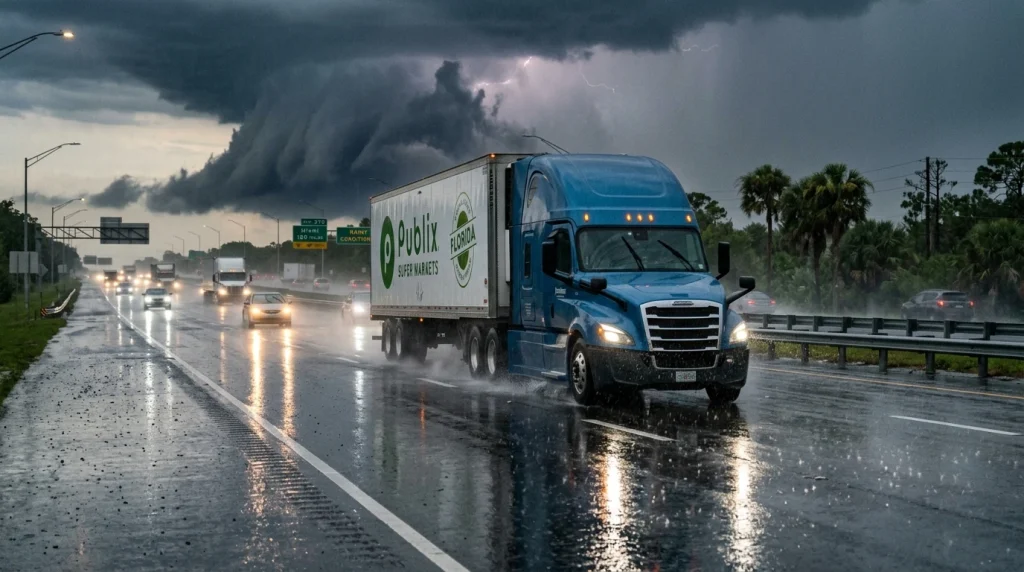

Tropical Storm Bertha continues to weaken as it moves west along the northern Gulf Coast, but it is still creating hazardous travel conditions across some of the most important freight corridors in the southern United States.
While most of Florida is no longer in the storm’s highest-impact zone, Bertha continues to bring heavy rain, gusty winds, rough surf, and localized flooding from the western Florida Panhandle into Louisiana. The system is then expected to continue toward Texas. For the trucking industry, the biggest concerns remain reduced visibility, standing water on highways, and possible delays along major freight routes such as Interstate 10 (I-10).
According to the National Hurricane Center (NHC), Bertha is producing maximum sustained winds of 50 mph (85 km/h) and is expected to continue weakening as it tracks west across the Gulf Coast.
Even so, rainfall impacts are expected to outlast the storm’s center, prompting weather advisories across several states. Transportation officials continue to encourage drivers to monitor forecasts and road conditions before traveling.
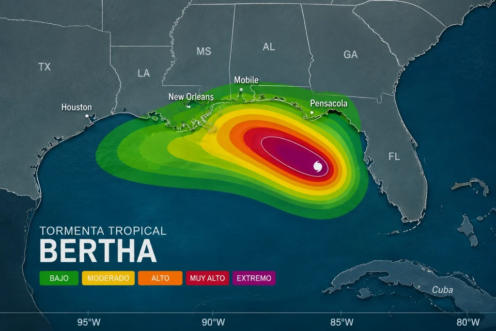
Where Is Tropical Storm Bertha Today?
Bertha’s center is moving near the mouth of the Mississippi River while tracking westward roughly parallel to the Louisiana coastline.
The official forecast calls for the storm to continue along the northern Gulf Coast before moving inland, where it is expected to gradually weaken into a tropical depression and eventually become a post-tropical system.
Meteorologists attribute the weakening trend to strong upper-level wind shear and increasing interaction with land. While some forecast models continue to evaluate the possibility of limited redevelopment south of the circulation center, the National Hurricane Center’s official forecast continues to show steady weakening.
Which States Are Still Under Bertha Alerts?
Although Bertha is no longer affecting the entire Gulf Coast, several states remain under tropical storm, coastal flooding, or heavy rainfall alerts.
The greatest impacts are expected across:
- Western Florida Panhandle
- Alabama
- Mississippi
- Louisiana
- Eastern Texas as the system continues moving west
Heavy rainfall could produce localized flash flooding, especially in urban areas and low-lying locations near rivers, streams, and coastal communities.
Is I-10 Open Between Florida and Louisiana?
Yes. Interstate 10 remains open between Florida and Louisiana, although driving conditions may change quickly depending on rainfall intensity and weather-related incidents.
I-10 is one of the most important freight corridors in the southern United States, linking ports, distribution centers, manufacturing facilities, and logistics hubs across Florida, Alabama, Mississippi, Louisiana, and Texas.
At this time, there are no widespread highway closures. However, transportation agencies warn that temporary restrictions, reduced speeds, standing water, crashes, and emergency response activities could create localized delays.
Which Highways Could Be Most Difficult for Truck Drivers?
In addition to I-10, several other major freight routes could experience hazardous conditions as Bertha moves across the region.
These include:
- Interstate 12 (I-12)
- Interstate 55 (I-55)
- Interstate 59 (I-59)
- US-90
- US-98
- Access roads to the Port of New Orleans
- Highways surrounding Lake Pontchartrain
- Freight corridors connecting Louisiana with eastern Texas
The primary concern on these highways is not hurricane-force winds but rather heavy rainfall, reduced visibility, standing water, localized flooding, and longer travel times.
Has Florida Moved Out of the Highest-Risk Area?
For the most part, yes.
Bertha’s strongest impacts are now limited to the western Florida Panhandle, particularly between Pensacola and the Alabama state line, where periods of heavy rain, gusty winds, and rough surf remain possible.
Meanwhile, cities including Miami, Fort Lauderdale, Orlando, Tampa, Sarasota, Naples, Fort Myers, Jacksonville, and West Palm Beach are no longer experiencing direct impacts from the storm and are outside the National Hurricane Center’s active warning areas.
This shift reflects Bertha’s westward movement and explains why the primary concern has transitioned away from most of Florida.
Is New Orleans Now the Gulf Coast’s Most Critical Area?
Yes.
The New Orleans metropolitan area and southeastern Louisiana have become the primary focus of weather concerns as Bertha approaches.
Tropical Storm Warnings remain in effect across portions of the region surrounding Lake Pontchartrain and the Mississippi River Delta, where heavy rainfall, coastal flooding, and storm surge remain possible.
Beyond the impact on local communities, the region is a vital transportation hub. The Port of New Orleans handles significant freight volumes every day, and thousands of commercial trucks travel through the area. Any disruptions on surrounding highways or port access roads can affect freight movement across multiple states.
When Will Bertha Reach Texas?
The National Hurricane Center expects Bertha to continue tracking west before reaching eastern Texas as a much weaker tropical system.
Although the storm will likely lose much of its tropical organization by that point, abundant moisture is expected to produce periods of moderate to heavy rainfall, increasing the risk of localized flooding.
Freight corridors connecting Louisiana with Beaumont, Port Arthur, and Houston could experience deteriorating travel conditions before the system dissipates.
What Risks Will Truck Drivers Face Over the Next 48 Hours?
For commercial drivers, the greatest threat is not wind speed but the road conditions created by persistent rainfall.
The most significant hazards include:
- Reduced visibility during heavy rain
- Standing water on highways
- Localized flash flooding
- Strong crosswinds affecting empty or lightly loaded trailers
- Traffic delays caused by crashes or temporary restrictions
Transportation officials recommend checking road conditions before every trip, following state Department of Transportation advisories, reducing speed during heavy rain, increasing following distance, and never driving through flooded roadways.
Although Bertha continues to weaken, its impacts will remain across the northern Gulf Coast for the next couple of days. As Florida moves out of the highest-risk zone, freight transportation concerns are shifting toward Louisiana and eastern Texas, where heavy rainfall and localized flooding are expected to remain the primary challenges for commercial trucking.
Remember, the best protection on the road is traveling with the right insurance coverage.
 Business hours: Monday to Friday from 8:00 AM to 5:00 PM. California time