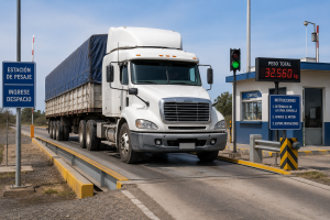
The polar wave continues to affect large parts of the United States, bringing low temperatures, heavy snowfall, and strong winds through Friday and into Saturday.
The National Weather Service (NWS) announced that the U.S. will experience a combination of significant weather events this Friday and over the weekend, including winter storms, critical fire conditions in the West, and rain across various regions. A low-pressure system carrying moisture and Arctic air has altered conditions across much of the southern and southeastern U.S.

Snow, ice, and freezing rain in the south and southeast
From early Friday morning, moderate to heavy snowfall spread from eastern Oklahoma and Arkansas into the Tennessee Valley, reaching the central Appalachians by nightfall.
The NWS predicted snow accumulations of 4 to 8 inches (10-20 cm) in areas near Memphis and the central Appalachians. South of the snow zones, a hazardous mix of freezing rain and sleet will impact northeastern Alabama, northern Georgia, and South Carolina. Ice accumulations exceeding 0.25 inches (0.6 cm) could disrupt travel and electricity in these areas.
Further north, from the Ohio Valley to parts of the northern Mid-Atlantic, lighter snow accumulations of 1 to 3 inches (2.5-7.5 cm) are expected. Temperatures, which have been 5 to 15 degrees below seasonal averages, will begin to moderate on Saturday, though they will remain cold.
Key state impacts:
- Alabama and Tennessee: Snow and sleet accumulations of 1 to 5 inches (2-12 cm) with up to 0.25 inches (6 mm) of ice. Dangerous road conditions, especially on bridges and overpasses, will persist until 8 a.m. Saturday.
- South Dakota and Wyoming: Heavy snow of 8 to 18 inches (20-45 cm) and wind gusts up to 40 mph (65 km/h) are expected from Saturday morning through Monday evening, reducing visibility and complicating travel.
- Georgia: Snow and ice accumulations of 1 to 3 inches (2-7 cm) and up to 0.4 inches (10 mm) of ice, with higher amounts in mountainous areas. Risk of power outages and slippery roads will last until 9 a.m. Saturday.
- Arkansas and Oklahoma: Snow accumulations of 7 to 11 inches (18-28 cm). Hazardous conditions will impact travel until 2 p.m. Friday due to ice-covered roads and bridges.
- Missouri and Tennessee: Significant snowfalls of up to 8 inches (20 cm) in some regions. Warnings remain active until 6 a.m. Saturday, with potential power disruptions.
- Texas: Light freezing rain or snow in Fort Worth and northern areas may cause minor ice accumulations and slippery road conditions.

Rain in the Northwest and snow in the Rockies
A fast-moving cold front entered the Pacific Northwest on Friday, bringing rain to low-lying areas and snow to mountain elevations. The Cascade Mountains and the Great Basin will see significant snowfall, extending into the central and northern Rockies.
By Saturday, the low-pressure system associated with this storm will move into the northern Plains and Midwest, leaving 1 to 3 inches (2.5-7.5 cm) of snow across Montana, North Dakota, and the upper Mississippi Valley. Temperatures in these regions will remain cold but more moderate compared to the South.

Fires and dangerous winds in California
In the western U.S., wildfires remain a threat in Southern California due to strong winds and low humidity. Gusts of up to 60 mph (96 km/h) were recorded in coastal areas Friday morning.
Although winds are expected to subside by afternoon, the combination of dry conditions and lingering gusts will sustain a high fire risk throughout the day.
The high-pressure system causing these conditions will begin weakening on Saturday. However, the NWS advises continued precautions in affected areas, as dry weather will still promote potential fires.

Gulf Coast: rain and possible storms
Rain will persist along the Gulf Coast through Friday and part of Saturday. While severe storms are not expected, the NWS warned of gusty winds associated with heavier rain in coastal areas of Louisiana, Mississippi, and Alabama.
In Florida’s coastal regions, winds of 15 to 25 mph (24-40 km/h), with gusts up to 40 mph (64 km/h), could lead to downed trees and power outages.
A cold front will push this system eastward, reaching the Carolinas by early Saturday. Rainfall in this region will remain moderate due to the presence of cold surface air, which limits the development of intense storms.
State impacts:
- Florida: Subfreezing temperatures as low as 28°F (-2.2°C) are expected in northern and northeastern areas, potentially affecting sensitive plants, outdoor pets, and vulnerable populations.
- Louisiana: West winds of 20 to 30 mph (32-48 km/h), with gusts up to 45 mph (72 km/h), will impact the southeastern part of the state, potentially displacing objects and causing power outages.
- Mississippi: Similar strong winds with gusts up to 45 mph (72 km/h) are expected in the southern region of the state.

U.S. labor market raises red flags on Wall Street
The U.S. labor market closed 2025 with clear signs of weakening, as evidenced by the latest employment data released in December. In the latest episode

DOT finds half of North Carolina CDLs were issued illegally
The DOT warns that half of North Carolina’s CDL licenses are irregular after a federal audit uncovered serious compliance failures. The findings directly affect truckers, fleets, and transportation companies, raising urgent questions about road safety, legal operations, and the future of the trucking industry.

California’s Unhealthy Air: Impacts on Trucking and Freight
Unhealthy Air Quality in California: What Repeated Pollution Alerts Mean for Trucking and Freight Operations

Global Road Freight on Track to Hit USD 5 Trillion by 2033
Global Road Freight on Track to Hit USD 5 Trillion by 2033 as e-commerce growth, supply chain restructuring, and technology adoption accelerate demand for road-based cargo transport worldwide.

California misses DOT deadline risking $160 million in federal funding
The state of California has reached the deadline set by the DOT to take action regarding the situation involving the number of non-domiciled CDLs issued

Health on Wheels: How to Prevent the Most Common Conditions on the Road
Health on wheels matters for anyone who spends long hours on the road. How to prevent the most common physical and mental conditions and maintain healthier routines while working behind the wheel.