 Hable con un agente al (888) 572-7520
  Enviar mensaje a un agente



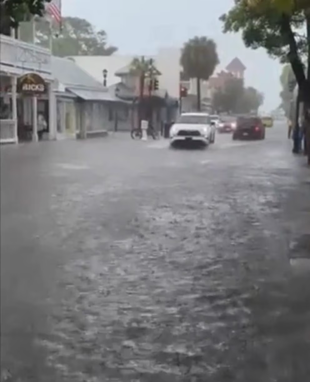
Florida is starting the week with weather conditions that require extra attention from truck drivers. A very slow-moving front, combined with abundant tropical moisture, is bringing rain and thunderstorms across large portions of the state, increasing the potential for flash flooding, standing water on roads and delays along some of Florida’s major transportation corridors.
The National Weather Service (NWS) has a Flood Watch in effect for Jacksonville and portions of Northeast Florida through 8 p.m. EDT Monday, October 5. The watch includes areas of Baker, Nassau, Hamilton, Columbia and Duval counties, among others.
The threat may extend beyond the beginning of the week. The Weather Prediction Center (WPC) expects showers and thunderstorms to continue as the front slowly moves south across the Florida Peninsula. By Tuesday, much of Florida remains under a marginal risk of excessive rainfall, with flooding possible particularly in urban areas and locations with poor drainage.
Jacksonville among the areas to watch closely
Northeast Florida is one of the areas truckers will need to monitor closely. In Jacksonville, the National Weather Service forecasts additional showers and thunderstorms, with an 80% chance of precipitation and further rainfall accumulations during the day and overnight.
Wet conditions are expected to continue Tuesday, when rain chances could reach 80% to 90% in parts of the Jacksonville area. Additional rainfall totals of one to two inches are possible, along with wind gusts of around 23 mph.
For truck drivers, the concern is not only the total amount of rainfall but also the possibility of storms repeatedly moving over the same locations. This pattern can cause water to accumulate quickly on streets, highway entrances, ramps and secondary roads.
The combination of a nearly stationary front and a continuous supply of moisture can allow multiple storm cells to follow the same path, increasing the risk of localized flooding.
Rain will continue moving across Florida
The Weather Prediction Center says the front will continue moving slowly south on Tuesday, primarily affecting the northern Florida Peninsula. Although the overall risk is considered marginal, the agency warns that a slow-moving storm or repeated thunderstorms over an urban area such as Jacksonville could create a more significant flash-flood threat.
By Wednesday, the front could become nearly stationary over Central Florida. The WPC maintains a marginal risk of excessive rainfall for portions of the peninsula, meaning weather and road conditions will need to be monitored throughout the week.
The weather could particularly affect truckers traveling along freight corridors in Northern and Central Florida, including areas near I-10, I-75, I-95 and I-4. This does not mean those highways are experiencing widespread closures. Conditions can change quickly, and restrictions will depend on the specific location.
Before beginning a trip or entering an area affected by thunderstorms, drivers can check FL511, the official real-time traffic information service from the Florida Department of Transportation (FDOT).
On Monday morning, FL511 was already reporting several incidents across the state highway network, including all eastbound lanes blocked on US-98 near Santa Rosa Boulevard in Okaloosa County, as well as incidents and construction in the Jacksonville area. Conditions may change throughout the day, so drivers should check FL511 before traveling through affected corridors.
This is not a hurricane
It is important to distinguish this weather event from a hurricane directly affecting Florida. The National Hurricane Center (NHC) reported Monday that there are no active tropical cyclones in the Atlantic, Caribbean Sea or Gulf.
However, the agency is monitoring another system that could become more important later in the week.
At 2 a.m. EDT Monday, the National Hurricane Center reported that a trough of low pressure had formed near the coast of Mexico over the southwestern Gulf. The NHC estimated a low, 10% chance of tropical formation during the next 48 hours and a medium, 50% chance over the next seven days. A tropical depression could develop during the second half of the week.
For now, this should be considered a system under observation, not a tropical storm heading toward Florida.
What truckers should keep in mind
Heavy rain can quickly transform driving conditions. Standing water can reduce traction, increase braking distance, conceal potholes or damaged pavement and significantly reduce visibility.
The greatest danger occurs when water completely covers a roadway. Drivers cannot always determine how deep the water is or whether moving water has damaged the pavement underneath.
Thunderstorms can also create problems at entrances to logistics facilities, on secondary roads, in low-lying areas and on highway ramps even when major interstates remain open.
Over the next several days, truckers traveling through Florida should check road conditions before departure and continue monitoring them along the way. FL511 provides real-time information on incidents, closures and traffic conditions, while the National Weather Service provides updated local weather alerts.
With rain expected to continue across different parts of Florida throughout the week, planning for possible route changes and avoiding flooded roads can help reduce risks and delays.
For truckers and fleet owners, severe weather is also a good time to review what protection their insurance policy provides for damage related to flooding, storms and other events that could affect a truck or its cargo. Review your policy, and if you have questions about your coverage, talk to Saint George Insurance Brokerage.
 Business hours: Monday to Friday from 8:00 AM to 5:00 PM. California time