 Hable con un agente al (888) 572-7520
  Enviar mensaje a un agente

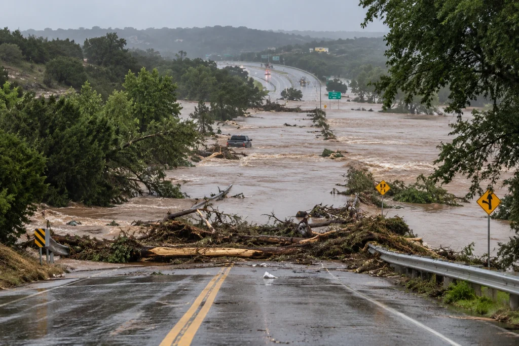

Heavy storms across Texas are raising the risk of flash flooding and could disrupt truck traffic along some of the state’s busiest freight corridors. The greatest concerns include the Texas Hill Country, the I-35 corridor, portions of North Texas, and the Houston and Gulf Coast areas.
The National Weather Service Austin/San Antonio has a Flood Watch in effect until 7 p.m. CDT on October 2 across a large portion of South-Central Texas. The affected area includes numerous counties in the Hill Country and along the I-35 corridor, including Kerr, Gillespie, Hays, Travis, Bexar and Comal counties.
Austin, San Antonio, San Marcos, New Braunfels, Kerrville, Fredericksburg and Boerne are among the communities facing potentially hazardous conditions. Several of these cities sit along or near major routes used to move freight between the U.S.-Mexico border, South Texas, Central Texas and markets farther north.
The latest NWS updates call for scattered showers and thunderstorms, with additional rainfall generally ranging from 0.5 to 3 inches. Localized totals could reach up to 6 inches where the strongest storms develop.
Flash flooding remains the primary concern, particularly in urban areas, creeks, drainage channels and low-water crossings. Heavy downpours can also sharply reduce visibility and cause water to accumulate quickly on roadways.
I-35: Use Caution Between San Antonio and Austin
The Interstate 35 corridor deserves particular attention. I-35 is one of Texas’ most important commercial transportation routes, carrying freight from the Mexican border through San Antonio, Austin and Dallas-Fort Worth and connecting with markets across the country.
Portions of the I-35 corridor are within areas affected by the severe weather. That does not mean the interstate itself is under a general closure, but heavy rainfall can create localized problems on entrance and exit ramps, frontage roads, intersections and secondary roads connected to the highway.
Conditions can also change quickly. A route that is open when a truck begins its trip may later experience standing water, crashes, congestion or temporary closures.
Before dispatching a truck or entering affected areas, carriers and drivers should check DriveTexas, the Texas Department of Transportation’s official source for current highway conditions and reported closures across the state.
Hill Country: Watch for Low-Water Crossings
The Texas Hill Country presents an additional hazard because of its numerous low-water crossings. These roads and crossings are built through low-lying areas near creeks and drainage channels and can become flooded quickly during periods of intense rainfall.
FWD issues Flash Flood Warning [flash flood: radar indicated] for Bosque, Hill [TX] till Oct 2, 9:00 AM CDT https://t.co/dpLIHu81MV pic.twitter.com/36SykzzbEB
— Texas Weather Alerts (@TexasStormAlert) October 2, 2026
The National Weather Service warns drivers never to attempt to cross a flooded roadway. In addition to the force of moving water, the pavement or structure underneath may have been damaged or washed away and may not be visible from the vehicle.
The warning applies to large vehicles as well. According to the NWS, 18 to 24 inches of moving water — approximately 46 to 61 centimeters — can carry away larger vehicles, including trucks, vans and SUVs.
The size and weight of a commercial vehicle therefore do not make a flooded crossing safe.
The NWS message is simple: “Turn Around, Don’t Drown.” If a roadway is covered by water or blocked by a barricade, drivers should find another route.
This is especially important for truckers traveling along US-281, US-290, I-10 and state or rural highways across the Hill Country, where localized closures can occur even while the major interstates remain open.
Houston: Rain and Scheduled Weekend Closures
The Houston metropolitan area and parts of the Gulf Coast are also facing potentially hazardous weather.
The National Weather Service Houston/Galveston continues to monitor thunderstorms and the potential for flooding. The heaviest rainfall could cause water to accumulate quickly in urban areas and locations with drainage problems.
At the same time, scheduled construction closures will affect several major Houston corridors during the weekend.
Houston TranStar reports construction along portions of I-610 West Loop, including overnight lane and ramp closures. Scheduled restrictions include northbound entrance ramps from FM-1093/Westheimer Road and San Felipe Street, along with alternating lane closures between San Felipe Street and Woodway Drive.
The restrictions are scheduled from the night of October 2 through early Monday, October 5, making it important for truckers entering Houston, traveling through the metro area or making weekend deliveries to check current conditions and detours before arrival.
Restrictions are also scheduled along portions of I-69, another important commercial freight corridor.
The combination of thunderstorms, wet pavement, reduced visibility and construction-related lane restrictions could increase travel times, particularly during periods of heavier rainfall.
What to Expect Saturday and Sunday
Weather conditions are expected to gradually change during the weekend, but the end of the heaviest rainfall does not necessarily mean every road will immediately return to normal.
As the system moves east, the threat of thunderstorms is expected to gradually decrease across different parts of Texas. However, following periods of intense rainfall, swollen rivers and creeks, flooded secondary roads and localized closures may persist.
That is particularly important in rural areas and around low-water crossings, where water levels can continue rising even after rainfall has eased.
More widespread improvement is expected by Sunday as drier air moves into the region, although conditions on individual roads will depend on rainfall totals and the response of rivers, creeks and drainage systems.
What Truckers Should Check
Commercial drivers traveling through Texas this weekend should check road and weather conditions immediately before beginning each leg of their trip.
DriveTexas provides official information on road conditions and closures across the state highway network, while Houston TranStar provides traffic, incident and closure information for the Houston metropolitan area.
For weather alerts and forecasts, drivers can check updates directly from NWS Austin/San Antonio, NWS Dallas/Fort Worth and NWS Houston/Galveston.
Drivers should also understand the difference between alert levels. A Flood Watch means conditions are favorable for flooding to develop. A Flash Flood Warning means flash flooding is occurring or imminent in the specified area and requires immediate action.
Carriers should also account for potential delays when planning fuel stops, parking, delivery schedules and available driving hours.
The Federal Motor Carrier Safety Administration (FMCSA) includes an Adverse Driving Conditions Exception within its Hours of Service regulations. Under certain circumstances, the provision can allow up to two additional hours for some driving and on-duty limits when drivers encounter qualifying, unforeseen adverse conditions.
The exception does not automatically apply simply because a storm or weather alert is in effect. FMCSA establishes specific requirements, so carriers and drivers should determine whether the conditions encountered during a particular trip meet those criteria.
With heavy rain, flooding risks and scheduled weekend construction, truckers traveling on I-35, I-10, US-281, US-290 or through the Houston area should monitor conditions in real time and never attempt to drive through a flooded roadway.
Before heading out, check your route and make sure your operation has the coverage it needs. TxDOT also provides live traffic and roadway information.
If you have questions about coverage for your truck or cargo, contact Saint George Insurance Brokerage.
 Business hours: Monday to Friday from 8:00 AM to 5:00 PM. California time