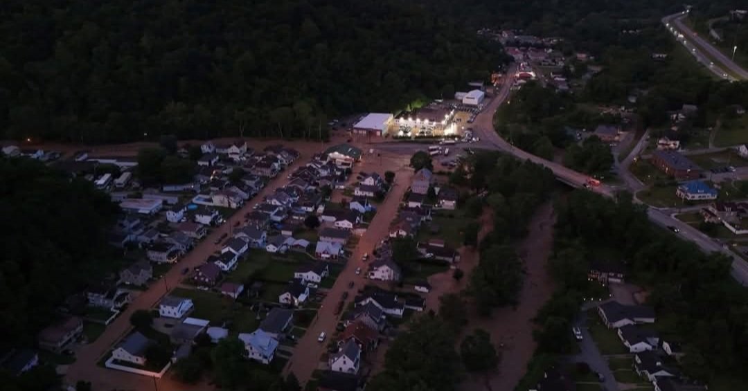
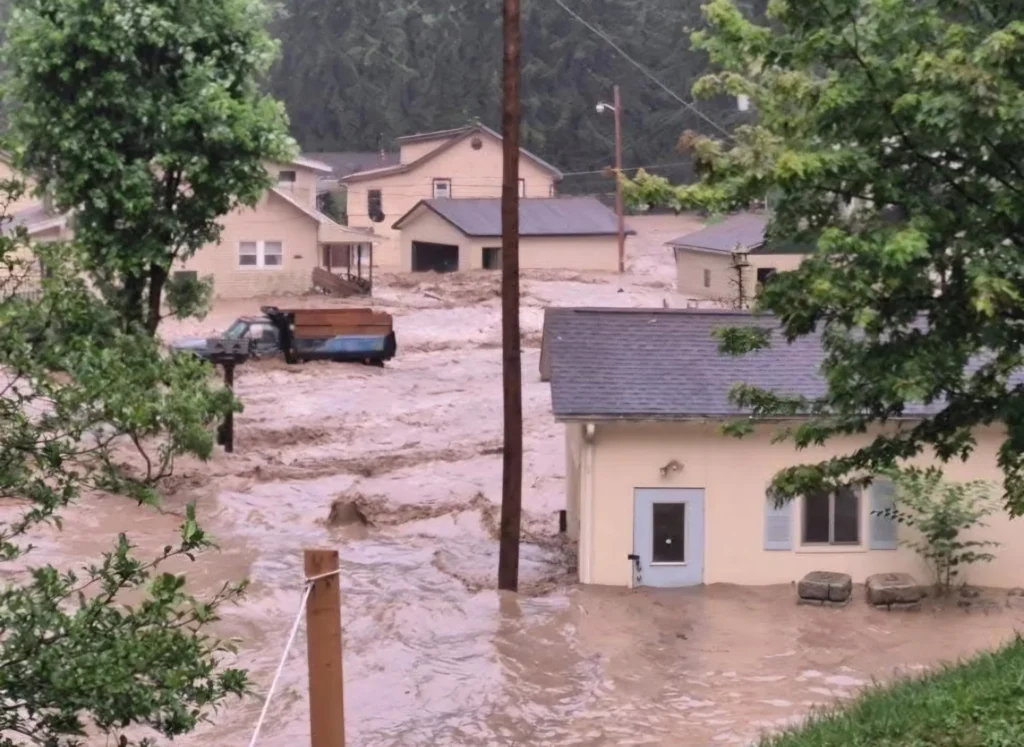
A wave of torrential rain has battered southern Texas and northern West Virginia in recent days, triggering devastating floods. Authorities have declared a state of emergency in both regions, with more than 80 roads and intersections closed.
A wave of torrential rainfall swept through southern Texas and northern West Virginia over the past few days, causing devastating floods that have left at least 18 people dead and several others missing.
In San Antonio, 13 people lost their lives after being swept away by overflowing creeks, while in Wheeling and other northern West Virginia counties, at least 5 fatalities have been confirmed.
Authorities have maintained a state of emergency in both regions, with over 80 roads and intersections closed, structural damage, ongoing evacuations, and rescue operations. The weather forecast anticipates more storms in the coming days, which could further worsen the situation.
1. Situation in San Antonio, Texas
On Thursday, June 12, a sudden torrent of water—6 to 8 inches (15–20 cm) in just three hours—caused the Perrin Beitel, Salado, and Leon Creeks to overflow, resulting in a tragedy that claimed the lives of 13 people.
Identified victims: Among them Roseann Cobb (41) and Derwin Anderson (43); Derwin was found near Callaghan Road and US‑90. A total of 12 out of the 13 victims have been identified.
Rescue: The San Antonio Fire Department (SAFD) saved 10 people who were trapped in floodwaters or clinging to trees.
Damaged infrastructure:
Rodriguez Park, Woodlake, Comanche, and Coyote Dog Park were affected by floods and temporarily closed.
Olympia Hills Golf Course remained closed until June 16 due to damage from debris and surging waters.
1.1 Roads and Intersections Closed in San Antonio
According to city reports, Bexar Flood, and KSAT:
Loop 410 / Perrin Beitel Rd: completely closed; floodwaters swept away vehicles on and off the road.
Callaghan Rd @ US‑90 (Leon Creek) and Wurzbach Parkway: closed and marked as rescue zones; bodies were recovered here.
Vicar Drive at Beitel Creek and Old O’Connor Road: severe damage; bridges and intersections closed indefinitely.
Mauermann Rd, Leslie Rd, Lookout Rd, Old Grissom Rd, Bitters Rd, Culebra Rd: over 42 roads closed due to flooding.
I‑35 (lower level at San Pedro Ave.): temporarily closed due to high water; now reopened.
Bexar County’s HALT System: activated; automatic alerts at low-water crossings. Residents are advised to avoid flooded areas.

2. Situation in Wheeling and Northern West Virginia
On Saturday, June 14, powerful storms dropped between 2.5 and 4 inches (6–10 cm) of rain in just 30 minutes across Wheeling, Ohio County, Triadelphia, Valley Grove, and Marion County.
Victims: Between 4 and 5 confirmed dead, including a 3-year-old child; at least 3–4 individuals remain missing.
Emergency: Governor Morrisey declared a state of emergency in Ohio and Marion counties; the National Guard has been deployed.
Rescue: Hundreds of emergency calls, 165 in Marion County alone. Search efforts using drones, dogs, and swift-water rescue teams are underway. Twelve people are staying in temporary shelters.
Our proud state is experiencing some rough flooding right now with rain in the forecast for the rest of the week.
— 🕸TheDailyBagel 🕸 (@LukeWolf04) June 16, 2025
💙💛#WestVirginia #Floods #USA #UnitedStates #BreakingNews pic.twitter.com/ofkMXDMLBQ
2.1 Roads Affected in West Virginia
Local and WSAZ reports confirm:
At least 40 roads are closed or blocked by debris in Wheeling–Ohio County.
National Road is closed between WV‑88 and Mount de Chantal, and from Triadelphia to Valley Grove.
WV‑88 near Warden Run Road: closed due to flooding and landslides.
Elm Grove, Overbrook, Lumber Avenue, Shilling Bridge: partial closures, trapped vehicles, and significant water bodies in the area.
Marion County: multiple road closures in Pleasant Valley and Fairmont; partial collapse of a residential complex reported.
Over 4,000 power outages and gas leaks, complicating safe reopening of roadways.
3. Weather Forecast and Alerts
San Antonio: Hot and humid with possible isolated storms in the afternoon from Monday, June 16 through Wednesday, June 18. From Thursday to Sunday, the risk of thunderstorms and localized showers increases.
Wheeling (WV): Variable cloudiness with strong storms expected nearly every afternoon from Monday through Sunday. Warm, humid conditions with temperatures between 77–88°F (25–31°C).
Urgent advisories: Flood watches and flash flood warnings remain in effect during heavy rainfall events.
4. Recommendations and Safety Guidelines
🛑 Avoid flooded roads – even seemingly shallow areas can be deceptively dangerous. Heed HALT alerts in San Antonio and WV511 warnings in West Virginia.
⚠️ Watch for closures in critical zones – including Loop 410/Perrin Beitel, I‑35 (San Pedro), Callaghan/US‑90, Vicar Drive, Old O’Connor in San Antonio; and National Road, WV‑88, Shilling Bridge in West Virginia.
📻 Stay tuned to weather alerts – monitor the NWS, WV511, local news outlets, and official emergency updates.
🆘 Prepare for outages – in flooded zones, have flashlights, bottled water, and a battery-powered radio on hand.
👨👩👧👦 Have a family emergency plan – identify alternate routes, meeting points, and local shelters.
5. Current Status and Next Steps
San Antonio: Rescue operations have concluded; 13 bodies recovered. Infrastructure and park repairs are underway. HALT system remains active.
West Virginia: Search for missing persons continues. Restoration of essential services and road clearing efforts are ongoing. Additional storms may hinder progress in the coming days.

Gamers in Control Towers: How the Air Traffic Controller Shortage Is Impacting Logistics
The growing shortage of air traffic controllers in the United States is already affecting logistics and trucking, creating delays, disrupting supply chains, and increasing pressure on road transportation.

How to avoid ELD violations: common mistakes truckers make
Violations related to Electronic Logging Devices (ELDs) are among the most common issues found during roadside inspections by the Department of Transportation.

Drive your stress away: techniques for truck drivers
Approximately 75% of truck drivers report feeling emotionally stressed at work, and very few have the tools to cope with these situations or seek help.

California vs. Washington: regulatory dispute over trucks in the U.S.
California, the most populous state in the country, wants to remove diesel trucks from its roads. Washington wants exactly the opposite. In between, thousands of fleets are left unsure about which engine to buy.

Volvo Pushes Beyond Diesel with New Hydrogen Combustion Truck Trials
Volvo Trucks is once again taking the lead, beginning road tests with heavy trucks equipped with hydrogen combustion engines.

Trucker Fashion: A Revolution Born on the Road That Still Sets the Trend
Trucker fashion remains relevant due to its authenticity, its seamless integration into streetwear, and its reinterpretation by luxury brands, consolidating itself as a revolution born on the road that evolved from a work uniform into a global cultural symbol

